This page gives you detailed instructions on finding La Verrerie once you are in the general area. To get to the general area, first see the “Driving” tab.
NOTE we STRONGLY advise you take a copy of this page with you, it will help you find the actual house once your SatNav has brought you to the village. SatNav address finding will NOT find the actual address for you in France.
Maps and links
Here’s a Multimap link centred on La Verrerie.
Here’s an excerpt from the local “IGN” map, showing the local road from Sauxillanges.
My Garmin SatNav software says the Lat/Long are N 45 33.672 E 3 24.609 (Degrees, Minutes and decimals of minutes, WGS84 datum).
Directions to La Verrerie from Issoire.
From A75 Jct 13 take the left turn at the top of the slip road, then at the roundabout join the D996 signposted Sauxillanges – 10Km. After about thee miles you will come to Parentignat – drive straight though (last exit at the first roundabout) still following the D996 towards Sauxillanges and Condat. You will reach Sauxillanges about 15-20 minutes after leaving the motorway.
Directions to La Verrerie from Sauxillanges.
When you reach Sauxillanges, please take care. You are going to drive straight through the town but to do that you’ll pass through at least three points where the road is too narrow for two cars – there’s no “right of way” just play nice with the friendly locals – and at least two junctions which, as there are no road markings, conform to the “Prioity a droit” rule. That is, anyone to your right, even if you think of them as “coming out of a side road” will expect you to give way. Just take it slow and easy. J On leaving Sauxillanges you’ll find you’re now on the D39 and it’s signposted to Condat and Echandelys, and also to Egliseneuve – 6Km. After a couple of miles, you’ll find the D39 merges with the D705 (which joins from the right over a bridge). That only lasts about quarter of a mile after which you will come around a right hand bend over a bridge and find the D705 junction on your left signposted Egliseneuve-des-Liards (and the D39 continues to Condat and Echandelys). Take the Egliseneuve road, and take care as its often slippery and in places not *quite* as wide as two cars in a hurry! This road starts fairly straight but after a mile or so starts to snake as it follows the side of the valley where it’s been eroded by side-streams. The third such side-stream has a bridge which has a stone wall on the left and a crash barrier on the right (it’s the first bridge you’ll come to with such structures.) Immediately after this bridge you need to turn right – there is a signpost saying La Verrerie but it’s faded and at a funny angle.
You now wind up a narrow lane into the hamlet of La Verrerie. After the “please don’t run over our kids” sign (which is also at a jaunty angle) ignore the first right turn which will take you into a farmyard, but take the second right past the green hooded “local noticeboard”. Towards the end of the road you’ll find our house just before the farm. Smaller cars can get into the drive past the house but larger cars will have to park in the front – backing in makes getting out easier but try not to back into the big dip! There’s space for several cars with care, remember you may be sharing the space with residents of the other apartment.
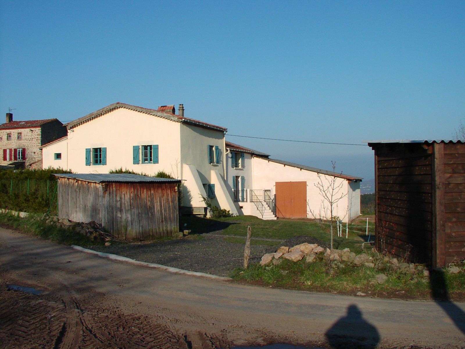
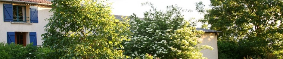
Here’s a picture of the house as it appears from the street – in this picture you’ll be arriving from the right. There’s a creeper growing up the face of the house now and the twiggy tree just to the right of the driveway is now a 30 foot horse chestnut. (OK – I’ll take a new picture soon!!)
Directions to La Verrerie from Echandelys.
If you’ve taken the mountain route from St Etienne or Lyon airport, you’ll come over the top of the last pass and enter the village of Echandelys. There are two routes from here.
The first, conventional route follows the D39 down through Condat (Condat-les-Montboissier) and then continues on down the D39 until just before you reach Sauxillages, you will find the D705 departing on your right.
The D39 is a very picturesque road following the river L’Osteaux. But it’s very wiggly and takes you on a dog-leg. But the route is easy to find. The second route is harder to follow, and includes a section of un-made-up road. This isn’t so severe as to need a 4×4 except perhaps in midwinter but you do need to take it carefull!
Start as above on the D39 to Condat. After leaving Condat, take the steep right fork which is signposted to a number of hamlets including “Logis”. Follow this road up the hill into the forest, around a few bends and through the hamlet of Logis, where you bear left. A while further and you’ll cross a crossroads, then pass the hamlets of Lorbagnat on the left and La Chassagne on the right, then you’ll come to a five-way crossroads. The right road leads to the hamlet of Chantagrelle, sharp right to a farm, and left down to the main D39 at Boude. But straight over takes you onto a rough track. This is an official road, not a private drive, but it isn’t metalled, and its marked as unsuitable for heavy traffic. Take care up here – mostly straightforward but there are some potholes and “washboard” sections, best taken slowly. This section is only about half a mile long, after which you re-join “proper” roads, and come to a T-junction. Bear left, drive up into Egliseneuve, turn left in the village centre (but don’t fail to note the keep-right sign at the cross which is in effect a roundabout) and then take the left road immediately after the last house on the left. This takes you down the hill into La Verrerie. You’ll see the gite across the field to your left as you descend the steep hill into the hamlet. The trickiest part of this route is, when reversing it, make sure you take the correct exit at the five-way junction – it’s the fourth from the left.
The Moutain Route from St Etienne.
From St Etienne (Boutheon) airport, or after leaving the St Etienne/Lyon motorway at Jct 8…
Pick up the D8 heading for Montbrison. This should leave Boutheon to the west; if you can’t find it (the junction is horrible) don’t panic, instead head north up the N82 towards Montrond a mile or two then you can cut across to the D8 by turning left in Veauchette.
The river you cross here is the Loire! Yes, the same one – it’s a very long river.
Just before Montbrison, turn left onto the D996, signposted “St Anthème”. Follow this road all the way to and through St Anthème and onwards towards Ambert. You’ll cross the pass of “Col de la Croix de l’homme mort” (Dead Man’s Cross) just before St Anthème, then “Col Pradeaux” about half way from St Anthème to Ambert. Both of these are over 1100m above sea level.
Once you get to Ambert, drive down into the town. At the crossroads, go straight over, until you get to the railway station, where you turn right, then left to cross the railway and river. Continue to bear left until you’re around behind the station then you take the right hand turn as the D996 continues. It’ll be signposted St Amant-Roche-Savine and Culnhat. Pass Le Monastier then just as you reach the top of the pass “Col des Fourches” take the left turn (D39) towards St Germain. After about 4k, take the right turn (still D39) towards St Eloy la Glaciere. At the crossroads in St Eloy (watch it – no signed priority so give way to the right!) go straight over. Continue on the D39 over the top and down to the town of Echandelys, then continue as above.


